There has been a bit of a lull in the Atlantic hurricane season since Hurricane Oscar hit parts of Cuba last month, with remnants then soaking parts of Atlantic Canada.
But the tranquility is now over as the U.S. National Hurricane Center is looking at three disturbances in the Atlantic at the moment, one of which came roaring to life as Subtropical Storm Patty on Saturday morning. It is the 16th named storm of the current Atlantic hurricane season.
DON’T MISS: Autumn can still produce intense hurricanes across the Atlantic


Patty, situated in the North Atlantic, is currently centred about 200 kilometres south-southeast of Lajes Field in the Azores. It has current wind speeds of 85 km/h and is moving east near 30 km/h.
An eastward to east-northeastward motion is expected during the next couple of days. On the forecast track, the centre of Patty is expected to move near the southeastern Azores during the next several hours.
Maximum, sustained winds are near 85 km/h with higher gusts. Weakening is expected during the next couple of days, and Patty is forecast to become a post-tropical low later today or early Monday.


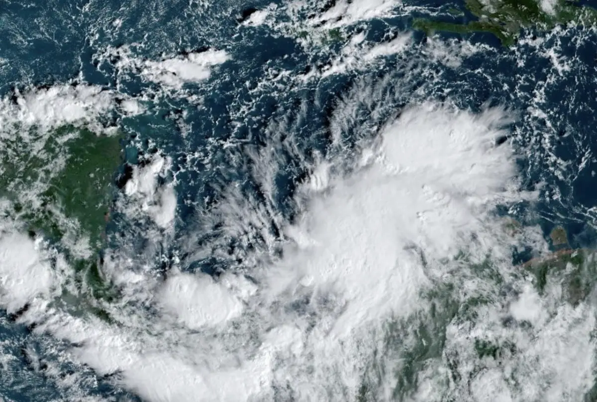
The second of those disturbances, located in the southwestern Caribbean Sea, has a 90 per cent chance of developing into a tropical depression within the next seven days.
Gradual development of this system is expected, and a tropical depression is likely to form within the next couple of days while moving generally northward to northwestward over the central and western Caribbean Sea.
Regardless of development, locally heavy rains are possible over portions of the adjacent land areas of the western Caribbean, including Jamaica, Hispaniola, and Cuba. Interests in the western Caribbean Sea should monitor the progress of this system as tropical storm watches or warnings could be required later today or tonight for portions of the area. An Air Force Hurricane Hunter aircraft is scheduled to investigate this system later today.
If the storm does get named, as the high chances indicate, it will become Rafael, the 17th named storm of 2024.


Impacts to the U.S. are unknown at this time, but the storm could move northwards next week, bringing heavy rain, gusty winds and rough surf.
Meanwhile, there is a third system stationed near the Greater Antilles, but its chances of tropical enhancement are low over the next seven days (10 per cent). A trough of low pressure a few hundred kilometres east of the southeastern Bahamas continues to produce disorganized showers and thunderstorms, along with gusty winds, over the adjacent waters of the southwestern Atlantic.
Slow development of this system is possible during the day or so while it moves westward toward the southeastern Bahamas and eastern Cuba. This system is expected to be absorbed into the low-pressure area over the Caribbean Sea (AL97) by late Monday, ending its chances of development.


Regardless of formation, locally heavy rains are possible during the next couple of days across the northern Leeward Islands, Puerto Rico, Hispaniola, eastern Cuba, and the southeastern Bahamas.
This serves as a good reminder that the Atlantic hurricane season officially runs until Nov. 30, so it’s important to remain vigilant and prepared throughout this month, as well.
Thumbnail courtesy of NOAA.


Leave a Comment